
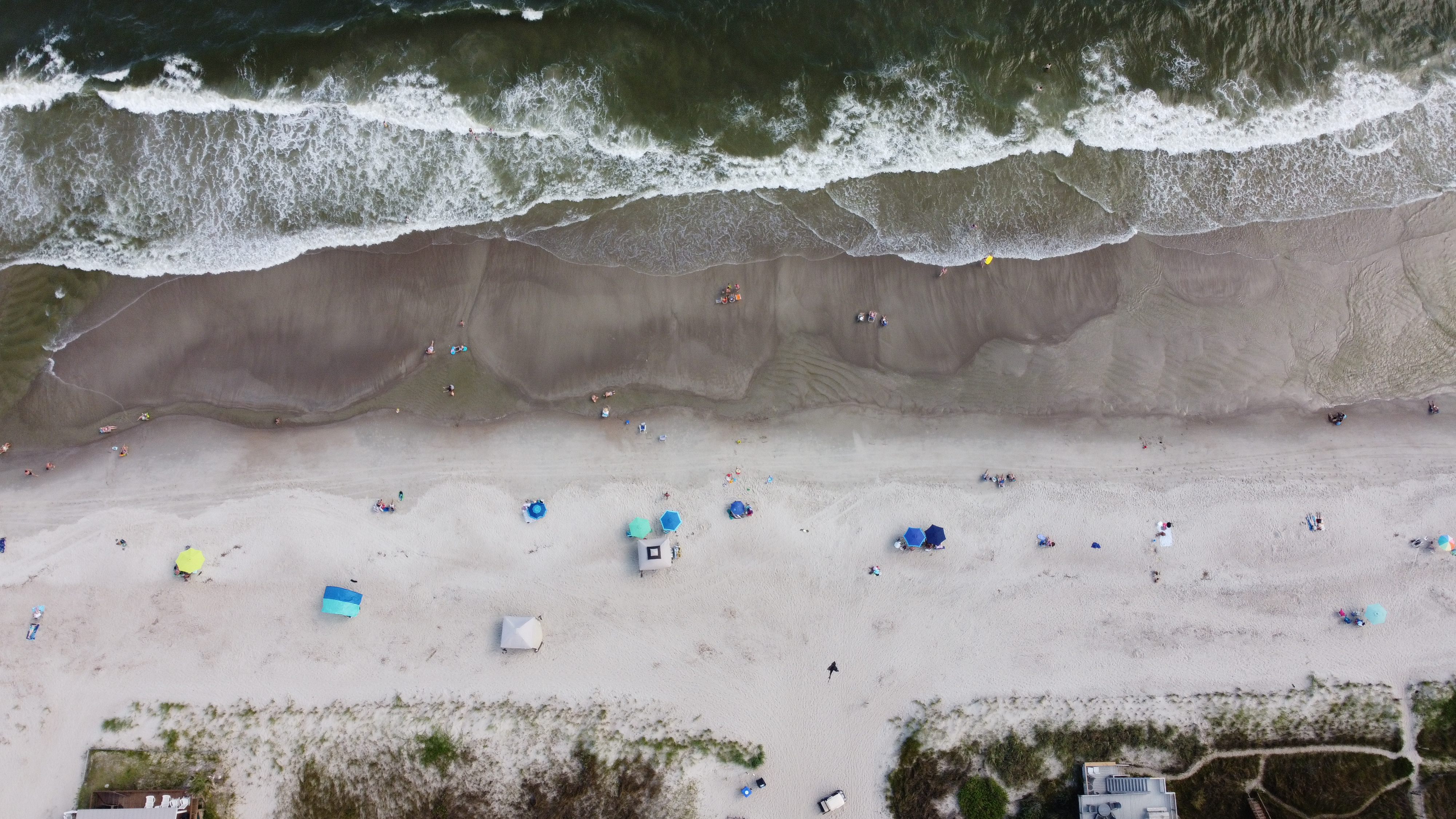
Oak Island coastline photographed July 2020. Photo: Patrick Reynolds / Wikimedia Commons (CC BY-SA 4.0). Historical image; not a view of the 2025–2026 beach nourishment work.

Nearly two million cubic yards of sand, a $40 million funding plan in Oak Island and continuing erosion concerns reveal the challenges and costs of protecting Brunswick County’s beaches.
By Oak Island–Brunswick Independent | The Coast
BRUNSWICK COUNTY, N.C. — The beaches that define Brunswick County’s coastline are constantly changing. Sand moves with the tides, waves and storms. Inlets shift, dunes erode, and stretches of shoreline that appear stable today may look very different after the next major coastal storm.
For the communities built along these barrier islands, protecting the beaches has become an ongoing public responsibility, one that requires engineering, environmental planning and substantial financial investment. Recent projects in Oak Island and Ocean Isle Beach illustrate both the benefits and limitations of trying to manage a coastline that never stands still. They also raise questions about the growing financial commitments required to protect coastal communities and who will pay those costs in the years ahead.
Oak Island: Nearly Two Million Cubic Yards of Sand
Oak Island recently completed one of its most significant beach nourishment efforts in decades. According to the Town of Oak Island’s project update, its 2025–2026 beach nourishment program involved approximately 1.955 million cubic yards of sand placed through three separate projects. The Lockwood Folly Inlet project provided approximately 100,000 cubic yards of sand to the western end of Oak Island.
The Wilmington Harbor project contributed another 800,000 cubic yards, while the town’s offshore nourishment project supplied approximately 1.055 million cubic yards. Together, these projects replenished significant portions of the beach and were designed to improve protection against erosion and storm damage. The town reports that the work was its largest non-emergency beach nourishment effort in more than 25 years.
Not every section of the beach received direct sand placement, but the town expects broader benefits as sand redistributes along the shoreline. The project was followed by additional maintenance work. In April 2026, town crews began leveling steep sand escarpments left after nourishment.
The work was intended in part to provide a more accessible beach surface for nesting sea turtles. By June, the town reported completing a dune vegetation project involving more than 300,000 plantings, primarily sea oats, to help stabilize public beach dunes. These improvements represent a substantial investment in shoreline protection.
In 2026, the American Shore and Beach Preservation Association named Oak Island’s Renourishment Project one of its Best Restored Beaches, recognizing the project’s restoration work, long-term monitoring and coordination among local, state and federal partners. The award recognizes project accomplishments; it does not eliminate the need to monitor future erosion or fund subsequent maintenance.
They also raise a continuing question: How long will the new sand remain in place before additional nourishment becomes necessary?
Ocean Isle Beach: When Protecting One Area Creates Questions for Another
At the eastern end of Ocean Isle Beach, near Shallotte Inlet, shoreline protection presents a different challenge. For decades, this portion of the island has experienced significant erosion. To address the problem, the town constructed a terminal groin, a hardened structure extending from the shoreline near the inlet that is designed to help retain sand.
The structure was completed in 2022 at a reported cost of approximately $11 million. Terminal groins influence the movement of sand along the shoreline. While they can help retain sand in targeted areas, they may also affect the amount of sediment reaching adjacent beaches.
That concern has become especially important at Ocean Isle Beach, where town monitoring identified increased erosion immediately east of the structure. The potential for increased erosion on the eastern side was identified during the federal environmental review before the project was constructed. In February 2026, Ocean Isle Beach sought a modification to its federal permit that would allow placement of up to 70,000 cubic yards of sand east of the terminal groin.
The permit in effect when the modification was requested did not authorize that placement. The request illustrates the difficulty of balancing protection of existing infrastructure with the natural movement of sand through an inlet system. OIBI has not independently confirmed whether federal regulators subsequently approved, denied or otherwise resolved the modification request.
The important question is not simply whether a shoreline protection project works in one location, but how its effects are measured across the surrounding shoreline.
Holden Beach and the Importance of Inlets
Holden Beach occupies a barrier island bordered by Shallotte Inlet to the west and Lockwoods Folly Inlet to the east. Both inlets influence nearby beaches through the movement of water and sediment. Inlet dredging can serve two purposes: maintaining navigable waterways and providing suitable sand for beach nourishment.
However, dredging, beach placement and shoreline stabilization require careful planning because sediment movement in one location can influence conditions elsewhere. For Holden Beach and neighboring communities, monitoring these changes is essential to understanding future shoreline management needs. The relationship between navigation channels and beach nourishment is particularly important.
Sand removed from an inlet or navigation channel may be suitable for beach placement, potentially allowing one project to serve both navigation and shoreline protection needs.
Sunset Beach and the Western Coast
Sunset Beach faces many of the same long-term coastal forces affecting Brunswick County’s other barrier islands. Waves, storms, tides and changes around nearby inlets influence the beach’s shape and condition. Although each town has different shoreline conditions, all must consider how erosion, public beach access, dunes and coastal development affect long-term planning.
The challenge is not simply maintaining an attractive recreational beach. Coastal dunes and beaches also provide a natural buffer between the Atlantic Ocean and developed properties. Sunset Beach’s shallow-draft navigation dredging project also illustrates the financial responsibilities associated with managing coastal waterways.
The project, completed in March 2024, included assessments charged to affected property owners. While navigation dredging differs from oceanfront beach nourishment, both demonstrate how managing coastal sand and waterways can create substantial public and private financial obligations.
Who Pays to Protect the Beach?
Protecting Brunswick County’s beaches requires more than moving sand. It also requires millions of dollars in public funding, long-term financial planning and decisions about how those costs should be shared. Oak Island provides a particularly revealing example of the financial commitment involved.
In November 2021, North Carolina’s 2021 budget legislation provided $20 million in matching funds to support Oak Island’s beach nourishment efforts. Under the town’s subsequent Beach Management Plan, another $20 million was identified from local funding sources, establishing a combined $40 million financing plan. The local contribution was not funded exclusively through the town’s sand tax.
According to the Town’s Beach Management Plan, the local financing plan identified approximately $9.1 million from accommodations tax funds, $7.1 million from the sand tax fund and $3.8 million from the general fund. These figures describe planned funding sources, not final expenditures. In June 2025, Oak Island Town Council unanimously awarded a beach nourishment construction contract of approximately $33 million to Weeks Marine. The contract was part of the town’s larger effort to restore and maintain its oceanfront shoreline.
The distinction between project financing and actual expenditures is important. The $40 million represented the town’s planned funding resources, while the $33 million represented the construction contract awarded in June 2025. These figures should not be confused with the final total cost of all nourishment-related work.
The town’s financial commitment also extends beyond this construction project. Oak Island’s adopted 2026–2027 budget designates three cents of its 20-cent property tax rate for its Beach Nourishment Fund. That represents 15 percent of the town’s property tax rate dedicated to beach nourishment.
In addition, Oak Island collects a 5 percent accommodations tax on qualifying short-term rentals. Two percentage points of that tax are specifically designated for beach protection and nourishment, while the remaining three percentage points support tourism-related purposes. The state also announced an additional $3 million Coastal Storm Damage Mitigation Fund award for Oak Island in August 2025.
The town subsequently approved an additional 114,000 cubic yards of sand for its offshore nourishment project using that funding. That award is separate from the original $20 million state funding commitment, although both supported the town’s broader beach protection efforts. The larger financial challenge is that beach nourishment is not a one-time expense.
Oak Island’s Beach Management Plan anticipates future maintenance nourishment projects approximately every six years, with estimated costs exceeding $30 million per cycle in the plan’s original dollar estimates. Actual future costs will depend on erosion, storms, construction prices and the availability of suitable sand. The plan also recognizes that unexpected storms or greater-than-anticipated erosion could require additional funding through borrowing, tax adjustments or other financial measures.
For residents and property owners, these commitments raise important questions. How much will local taxpayers be expected to contribute over the next 10, 20 or 30 years? How much future assistance will come from the state or federal government?
Will accommodations taxes and dedicated property taxes provide sufficient revenue to maintain the beaches without additional borrowing or tax increases? And how should local governments balance shoreline protection with other public infrastructure needs? Brunswick County’s beaches are both natural resources and important parts of the local economy.
Protecting them carries a substantial price, and understanding how that money is collected, spent and planned for the future is an essential part of public accountability.
Protecting More Than Property
Beach nourishment and dune restoration can help protect roads, utilities, homes, public access points and other infrastructure. They also affect wildlife and the natural coastal environment. Sea turtles depend on suitable sandy beaches for nesting.
Shorebirds use coastal habitats for feeding and resting. Dunes and vegetation help reduce wind-driven sand movement and provide some protection against storm impacts. Poorly planned shoreline work can disrupt these systems, making environmental monitoring an important part of coastal engineering.
The objective is not to prevent the coastline from changing, something no engineering project can guarantee, but to manage those changes while protecting public resources and coastal habitats.
Planning for the Next Storm
Brunswick County’s shoreline will continue to change regardless of how much sand is placed or how many structures are built. Oak Island’s recent nourishment work demonstrates the scale of investment communities are willing to make to maintain their beaches. Ocean Isle Beach’s continuing erosion concerns demonstrate the complexity of managing sand movement around an inlet.
Holden Beach and Sunset Beach face their own challenges as inlet conditions, navigation needs and shoreline changes influence future coastal management decisions. Together, these communities highlight the need for long-term planning, transparent financial reporting and careful evaluation of the results of shoreline protection projects. For residents and taxpayers, the most useful measure of success may not be how wide the beach looks immediately after construction, but how effectively each project performs over time—and at what cost.
As Brunswick County continues to grow, those questions deserve a prominent place in public discussions about the future of its coast.
Oak Island–Brunswick Independent reports on the natural environments, communities and public decisions shaping coastal Brunswick County.